Posts

Showing posts with the label DEM

Minimizing my lidar velodyne point cloud
Image
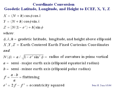
I think I should be reminding myself how I did the timestamping of the point cloud data with that of the GPS. Here are the seemingly easy steps. I converted the GPS data from geographic lat, long, ht to an ECEF(Earth-centered-earth-fixed) cartesian coordinate system using this formula: The reason for conversion into cartesian is so that I can easily do the translation from our velodyne device to the GPS antenna. I used the WGS84 reference ellipsoid parameters for conversion.   a  = 6,378,137 m , 1/f=  6,356,752.3142  Now after I got all my coordinates in X, Y, Z, I matched the timestamps in the LIDAR packets as that of the timestamp provided by the GPS. I then performed some translation based on the structure of the vehicle mount that we have fabricated for the fieldwork. Now my data is in X,Y,Z and ready for plotting in a point cloud software. When I'm finally down with the timestamping of the LIDAR with GPS, I am now overwhelmed by the number of points ...
How to view your DEM in 3D using ArcScene

Image
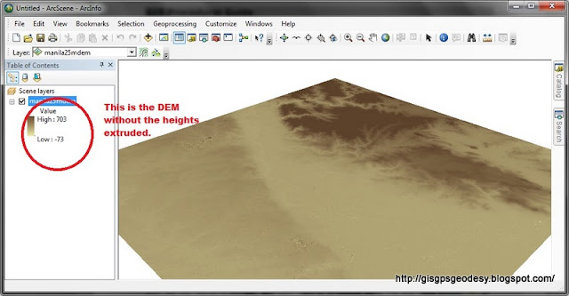
I have always used ArcScene for visualizing my GIS data in 3D. However, some issues may arise if your data, specifically DEM is in geographic coordinate system (latitude, longitude). You just have to do some minor settings to make things work really... Here's my fare share on viewing your DEM in 3D using ArcGIS ArcScene. (For this post I used ArcGIS 10.0, I have also tried it working in ArcGIS 9.3). Here's it. Enjoy your mapping and geovisualization everyone! :)

How to prepare elevation range of SRTM in ArcMap for 3d visualization in ArcScene

If you have a DEM, you might want to view it in 3D. For me, I do geovisualization in ArcScene, VTP or for simple presentations I use Google Earth. DEM or digital elevation models contain the heights of our terrain. It has a commonly interchanged counterpart term known as DTM (digital terrain model). DEM differs from DTM in the sense that DEM is not the elevation from the ground per se. It is the height with the buildings and other cultural features. DTM on the other hand gives the height of the bare ground. For DEM, we can obtain freely available datasets such as SRTM and ASTER . SRTM resolution is 90m X 90m for the Philippines while ASTER is 30m x 30m. Though ASTER is of higher ground sampling distance than SRTM, researches show that SRTM still proves to be more accurate than ASTER.  So for the purpose of visualizing our terrain in 3d. What we would first want to do is to prepare the DEM (i.e. SRTM DEM ) for processing. If we fail to do this, we will be confronted with a very...