Posts

Showing posts with the label Geomatics Engineering

Free Class Schedule Notification on your Mobile Phone using Google Calendar
Image
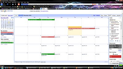
At long last, after one long week, I am finally enrolled for the 2nd sem AY 2010-2011. The entire enrollment experience has been really tedious and cumbersome because of usual queues, considering the enrollment is already online and automated. Anyways, I am now officially enrolled, so I would just have to tidy things up in my calendar. I set-up my Google Calendar to send me notifications of my scheduled class for the night on my mobile phone. The notifications are free so why not!It pays to be organized for some time anyways. Here's my schedule for this sem. And some other events/notifications on my Google Calendar. I created a test event for today and scheduled it to arrive 10 minutes before the time. Voila! I received a text message from Google saying: Reminder:test @ Thu Nov 11 12:20pm-1:50pm in PIVS (melanie's google calendar). Memorizing class schedule and room assignments have been quite a mess during my undergrad years. I used to print it and paste it on my not...

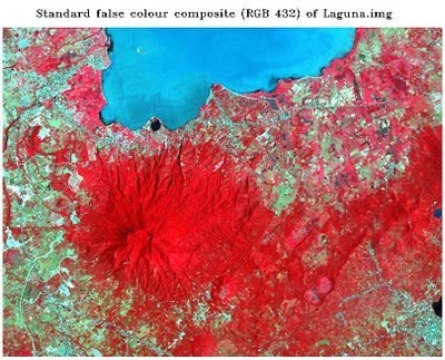
Image Registration and Georeferencing in ENVI (Cavite, Philippines)

Image
Georeferencing and Registration Methodology T he following steps were undertaken for the rectification or georeferencing of the image: 1. I have created a subset of the province of Cavite from the Landsat ETM+image that I have downloaded from GLCF . A topographic map of the equivalent subset has been obtained with the following basemap information. Fig. 1: Basemap information Scale 1: 50000.. Sheet name Cavite, Philippines Sheet number 3163 II Source NAMRIA 2.  A scanned 1:50000 topographic map of Cavite appears below. Fig. 2a: 1:50000 Topographic map of Cavite 3.  An Image-to-map registration was performed using the coordinates on the boundary of the map as ground control points. A total of 10 points are obtained with a total RMSE of 0.396853. 4.  An Image-to-Image registration was later performed, yielding 9 GCPs with a total RMS error of 0.970929. The Landsat ETM+ image that I have obtai...

Principal Components Analysis

Image
 Principal Component Analysis (PCA) aims to eliminate the interband correlation and the effective dimensionality of the data or image. The false color composite of the original Laguna.img file appears below. Fig. 1: Standard color infrared composite image   The satellite image from Google Earth of Los Banos, Laguna was also included for identification of features and their names. Fig. 1a shows the saved image. Fig.1a: Google Earth image of Los Banos, Laguna   After subjecting the original image to principal components analysis, a color composite using PC1,PC2,PC3 as R,G,B respectively was produced. The color composite image was shown in the figure that follows. Fig. 2: RGB = PC1,PC2,PC3 of Laguna.img The six principal component grayscale images appear below. Fig. 3: Output principal component images  The tonal patterns of the principal component image 1 differ with that of ETM+ band 1 of Laguna.img. Figure 4 shows the a generlized view of the sa...

University of the Philippines Diliman Campus

Image
In our GIS class for Geomatics Engineering, we were asked to digitize a pan-sharpened Quickbird image of UP Diliman and specify the roads, buildings, and open spaces in the campus. Also this is my first time to import data from a handheld GPS into my GIS. Here's my output map: We we're also asked to georeference a "very old" aerial photo of UP Diliman campus. Here's the result: