Posts

Showing posts with the label free gis data

Free and Open Data Reliability : The case of Open Street Map road data vs "PAID" data sets

Image
This is the very typical example why the people in our country should free our data! Shown above is a map of my road data for a hydrologic model. Two unaligned road networks are visible from the image above. The red lines are my initial datasets which are actually "PAID" dataset from a government agency. When I did an overlay with a pan-sharpened satellite image, I got a large shift from the actual road network visible in the image itself. My initial notion is to georeference the image so that it would fit the readily available road data. However, when I tried overlaying the location of my mapped inlets, I noticed that the storm drain network which is aligned with the road coincides with that of my backdrop image. These inlet locations are in-situ observations gathered from a week of fieldwork hence there must've been a BIG problem with my road dataset. My next solution is to look for a free dataset. I have tried using Open Street Map data and alas! OSM data has a...
Some Matlab scripting and coordinate axes glitches on my codes

Image
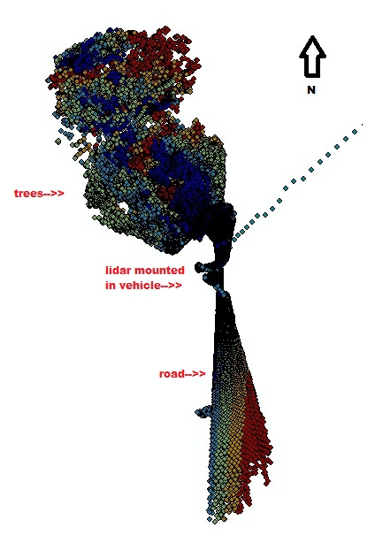
I had some problems using my previous Matlab script on generating the converted latitude, longitude and height from the ECEF -X,Y,Z coordinates. for k = 1:5     matFilename = sprintf('%d.csv', k);     M = ecef2lla(textread(matFilename));     dlmwrite('sample.xyz',M, '-append'); end What happens right here is that it writes formatted values of the latitude, longitude and height formatted in three columsn but in 5 significant digits only hence creating duplicated coordinates which scraped up most of my values in the sample.xyz. It took me the whole long weekend to figure out how to improve the results, I know it's on the formatting only and  not on the predefined classes per se.  As I've always been familiar with the %3.2f tag for specifying the decimal places in a float, I have been trying all the way to fit in my argument but to no avail. I'm almost giving up on using the "dlmwrite" function and tried using the "fprintf...

How to view your DEM in 3D using ArcScene

Image
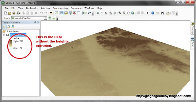
I have always used ArcScene for visualizing my GIS data in 3D. However, some issues may arise if your data, specifically DEM is in geographic coordinate system (latitude, longitude). You just have to do some minor settings to make things work really... Here's my fare share on viewing your DEM in 3D using ArcGIS ArcScene. (For this post I used ArcGIS 10.0, I have also tried it working in ArcGIS 9.3). Here's it. Enjoy your mapping and geovisualization everyone! :)

Free Open Street Map data (i.e.shapefiles etc.) for the Philippines

Free Road data extracted from Open Street Map made available by Cloudmade . philippines.ai.zip   (28.7M) philippines.img.zip   (8.3M) philippines.navit.bin.zip   (12M) philippines.osm.administrative.bz2   (627K) philippines.osm.bz2   (29M) philippines.osm.coastline.bz2   (3.5M) philippines.osm.highway.bz2   (16.2M) philippines.poi.gpx.zip   (521.7K) philippines.poi.tomtom.zip   (334.6K) philippines.poly   (2.3M) philippines.shapefiles.zip   (20.5M) Abra Agusan Del Norte Agusan Del Sur Aklan Albay Antique Apayao Aurora Basilan ...

Free Philippine Administrative Boundaries shapefile

Image
Free Administrative Boundary shapefile can be downloaded here . The coordinate reference system is latitude/longitude and the WGS84 datum. Other file formats such as ESRI geodatabase (.gdb), Google Earth (.kmz), and RData for RProject. Geospatial data from other countries are also available for download here. File Formats A "shapefile" consist of at least three actual files. This is a commonly used format that can be directly used in Arc-anything, DIVA-GIS , and many other programs. Unfortunately, non-latin characters are garbled. An "ESRI geodatabase" is an MS Access fole that can be opened in ArcGIS (an expensive but powerful program). One of its advantages, compared to a shapefile, is that it can store non-latin characters (e.g. Cyrillic and Chinese characters). A "Google Earth .kmz" file can be opened in Google Earth . A "RData" file can be used in R (with the sp package loaded) Some files have been compressed and grouped i...