Posts

Showing posts with the label geovisualization

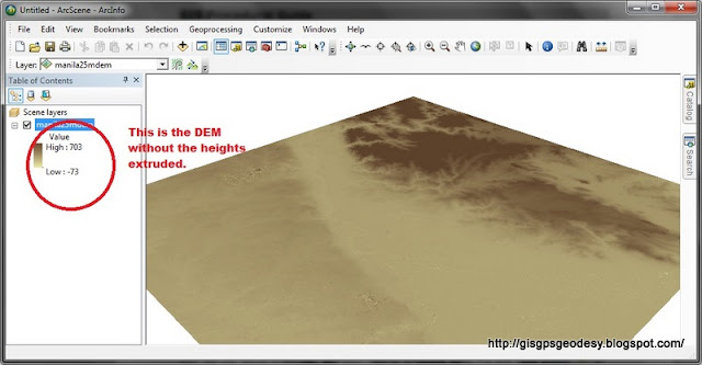
How to view your DEM in 3D using ArcScene
Image
I have always used ArcScene for visualizing my GIS data in 3D. However, some issues may arise if your data, specifically DEM is in geographic coordinate system (latitude, longitude). You just have to do some minor settings to make things work really... Here's my fare share on viewing your DEM in 3D using ArcGIS ArcScene. (For this post I used ArcGIS 10.0, I have also tried it working in ArcGIS 9.3). Here's it. Enjoy your mapping and geovisualization everyone! :)

Have you tried Google Fusion Tables?

Apart from the awesome Google Maps and Google Earth. Did you know that you could embed your spatial data in Google Fusion Tables? Google Fusion Tables is meant for visualizing your data in a spreadsheet. It produces cool charts (bar, pie, scatter, line) for just about any formatted table you have. You may input a spreadsheet directly from your Google Docs or you may also opt to create a new table from scratch. the steps are easy, just follow the step-by-step instruction at http://www.google.com/fusiontables / . Here's a cool line chart that I have created before. It shows the series of oil price hikes since we bought a car last year. It gives me an idea where our next gas refilling station will be. Pretty neat display too. And kudos for it being interactive. Yay! Now for the geospatial people/geek, you might want to try using this Google Fusion Tables for visualizing your latest database. As long as you have some data with spatial components i.e. geographic coordinates (...

How to prepare elevation range of SRTM in ArcMap for 3d visualization in ArcScene

If you have a DEM, you might want to view it in 3D. For me, I do geovisualization in ArcScene, VTP or for simple presentations I use Google Earth. DEM or digital elevation models contain the heights of our terrain. It has a commonly interchanged counterpart term known as DTM (digital terrain model). DEM differs from DTM in the sense that DEM is not the elevation from the ground per se. It is the height with the buildings and other cultural features. DTM on the other hand gives the height of the bare ground. For DEM, we can obtain freely available datasets such as SRTM and ASTER . SRTM resolution is 90m X 90m for the Philippines while ASTER is 30m x 30m. Though ASTER is of higher ground sampling distance than SRTM, researches show that SRTM still proves to be more accurate than ASTER.  So for the purpose of visualizing our terrain in 3d. What we would first want to do is to prepare the DEM (i.e. SRTM DEM ) for processing. If we fail to do this, we will be confronted with a very...