Adobe Acrobat Pro X features Distance Measurement Tool
I have long known that a geo-pdf can perform some analysis such as distance measurement and coordinate extraction but I really never found the need to use it before. Not until today!
My ArcGIS software failed to work and I have to do some measurement in a map using the given scale. Luckily, I remembered this cool feature of Adobe Acrobat and so I gave it a try.
Yeabah! I have just found out what I perfectly need. It's just for an area approximation so for this purpose, the distance measurement tool of Adobe Acrobat Pro X suffices.
Here's how you do it:
On the Tools Menu> Analysis choose Measuring tool. The toolbar will appear on the upper right portion where you will be able to choose measurement and snapping options.
Given the scale in the map, you can already perform distance analysis. (My measurements are colored red in the image below.)
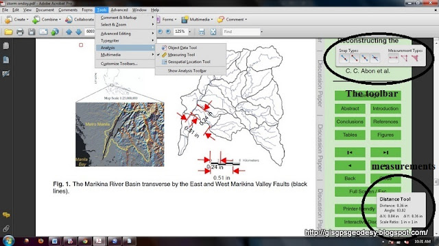
The figure above shows how I coordinated the distances within an area on the map with respect to a given scale.
If some coordinate information are embedded in the pdf, you can extract the location of a particular portion in the pdf document i.e. latitude, longitude of a point.
I think this is a pretty immediate resource that is really so helpful to us in the geospatial mapping field. :) Which also goes to show how mapping, measurement and geospatial information is so vital in our everyday life that Adobe already integrated it in their portable document format (PDF) readers. (^_^)


Comments
Post a Comment