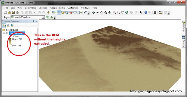
How to view your DEM in 3D using ArcScene
I have always used ArcScene for visualizing my GIS data in 3D. However, some issues may arise if your data, specifically DEM is in geographic coordinate system (latitude, longitude). You just have to do some minor settings to make things work really...
Here's my fare share on viewing your DEM in 3D using ArcGIS ArcScene. (For this post I used ArcGIS 10.0, I have also tried it working in ArcGIS 9.3).
Here's it.
Enjoy your mapping and geovisualization everyone! :)
Here's my fare share on viewing your DEM in 3D using ArcGIS ArcScene. (For this post I used ArcGIS 10.0, I have also tried it working in ArcGIS 9.3).
Here's it.
Enjoy your mapping and geovisualization everyone! :)


Comments
Post a Comment