Posts

Showing posts from November, 2011

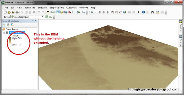
How to view your DEM in 3D using ArcScene
Image
I have always used ArcScene for visualizing my GIS data in 3D. However, some issues may arise if your data, specifically DEM is in geographic coordinate system (latitude, longitude). You just have to do some minor settings to make things work really... Here's my fare share on viewing your DEM in 3D using ArcGIS ArcScene. (For this post I used ArcGIS 10.0, I have also tried it working in ArcGIS 9.3). Here's it. Enjoy your mapping and geovisualization everyone! :)

How to view ESRI Shapefiles in Googlemaps

Image
OK so this is quite an inelegant solution but I have tried it though. :) I had the need to view a shapefile that I made in ArcGIS 10.0 and now I want to view it in Google Earth and/or Google Maps. So first if you have a shapefile, convert it to kmz format using the Arc Toolbox> Conversion>To KML> Layer to KML. A window will pop out. In the layer field, input your shapefile. Specify Output File in *.kmz format. Type "1" as Layer Output Scale. You're DONE! Navigate through the folder where you save your *kmz file and double click it to view it on Google Earth. Now the need to view it in Google Maps arises when I have to identify names of places that are not labeled yet in Google Earth. To view your KMZ in Google Maps, just save your KMZ file in a public URL and paste the URL in the Google Maps search bar. In my case, I have uploaded it to Dropbox , then I got the public link and paste it in Google Maps. Hope this helps. Happy mapping :)