Posts

Showing posts from 2011

How to view your DEM in 3D using ArcScene

Image
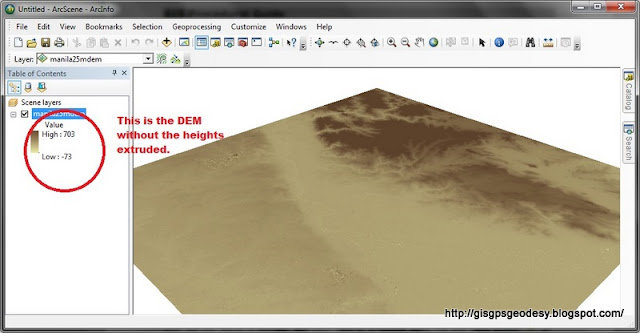
I have always used ArcScene for visualizing my GIS data in 3D. However, some issues may arise if your data, specifically DEM is in geographic coordinate system (latitude, longitude). You just have to do some minor settings to make things work really... Here's my fare share on viewing your DEM in 3D using ArcGIS ArcScene. (For this post I used ArcGIS 10.0, I have also tried it working in ArcGIS 9.3). Here's it. Enjoy your mapping and geovisualization everyone! :)

How to view ESRI Shapefiles in Googlemaps

Image
OK so this is quite an inelegant solution but I have tried it though. :) I had the need to view a shapefile that I made in ArcGIS 10.0 and now I want to view it in Google Earth and/or Google Maps. So first if you have a shapefile, convert it to kmz format using the Arc Toolbox> Conversion>To KML> Layer to KML. A window will pop out. In the layer field, input your shapefile. Specify Output File in *.kmz format. Type "1" as Layer Output Scale. You're DONE! Navigate through the folder where you save your *kmz file and double click it to view it on Google Earth. Now the need to view it in Google Maps arises when I have to identify names of places that are not labeled yet in Google Earth. To view your KMZ in Google Maps, just save your KMZ file in a public URL and paste the URL in the Google Maps search bar. In my case, I have uploaded it to Dropbox , then I got the public link and paste it in Google Maps. Hope this helps. Happy mapping :)

Adobe Acrobat Pro X features Distance Measurement Tool

Image
I have long known that a geo-pdf can perform some analysis such as distance measurement and coordinate extraction but I really never found the need to use it before. Not until today! My ArcGIS software failed to work and I have to do some measurement in a map using the given scale. Luckily, I remembered this cool feature of Adobe Acrobat and so I gave it a try. Yeabah! I have just found out what I perfectly need. It's just for an area approximation so for this purpose, the distance measurement tool of Adobe Acrobat Pro X suffices. Here's how you do it: On the Tools Menu> Analysis choose Measuring tool. The toolbar will appear on the upper right portion where you will be able to choose measurement and snapping options. Given the scale in the map, you can already perform distance analysis. (My measurements are colored red in the image below.) The figure above shows how I coordinated the distances within an area on the map with respect to a given scale. If some c

Flood inundation map of typhoon Pedring along Cagayan Valley, Philippines

Image
Extreme typhoons have been frequenting the Metro lately. Metro Manila has just then experienced torrential winds during typhoon Pedring, a day after the 2nd anniversary of the dreaded Ondoy.- September 27, 2011. Just when I thought that the return period of Ondoy is 180 years, it took just two years to strike us once more. Though typhoon Pedring really centered it's devastation on the outskirts of the Metro, it has definitely cause just another impact in the urban center. Here's the initial map on the coverage of the recent flood along Cagayan Valley, Philippines. Note that the inundation is under estimated for the scale used of the dataset used in generating this analysis. A high-resolution file of this map is available here .

What’s a Healthy Deal?

Image
With the proliferation of many deal sites and group buying sites, it's a rare opportunity that I get to encounter a deal site that mainly focuses on health and well being. This is one HEALTHY DEAL really! So what is a Healthy Deal after all? - It's like getting healthy while getting wealthy. It's a more of like hitting two birds with a stone. Just as we know of the famous cliche that HEALTH IS WEALTH, it is with much elation that I get to encounter both in a single deal. For us who truly value our money, we can be as "kuripot" with our buying. As much as possible we want to get the cheapest without sacrificing on the quality of service that we get. So that's when we get WEALTHY! Because we can be thrifty and save, we know we are handling our finances well hence getting wealthy soon after that. Now for the healthy part, Healthy Deals Philippines  is the newest and only group-buying site in the Philippines that offers health and wellness deals, coupons an

Have you tried Google Fusion Tables?

Apart from the awesome Google Maps and Google Earth. Did you know that you could embed your spatial data in Google Fusion Tables? Google Fusion Tables is meant for visualizing your data in a spreadsheet. It produces cool charts (bar, pie, scatter, line) for just about any formatted table you have. You may input a spreadsheet directly from your Google Docs or you may also opt to create a new table from scratch. the steps are easy, just follow the step-by-step instruction at http://www.google.com/fusiontables / . Here's a cool line chart that I have created before. It shows the series of oil price hikes since we bought a car last year. It gives me an idea where our next gas refilling station will be. Pretty neat display too. And kudos for it being interactive. Yay! Now for the geospatial people/geek, you might want to try using this Google Fusion Tables for visualizing your latest database. As long as you have some data with spatial components i.e. geographic coordinates (

Applying inSAR principles to detect surface deformation in Metro Manila

Image
I have just attended an InSAR training  showing how to detect surface deformation through phase differences between SAR signals. SAR satellite transmits microwave to earth and receives reflected microwave signals from earth surface. The intensity of received microwave indicates electromagnetic characteristics of objects, and phase indicates distance between aperture and object. Surface deformation is measured by the difference in two observed phases. The observed phase differences still contains errors that ought to be corrected along processing enumerated by the steps below. Getting SLC (Single-Look Complex) Co-registration (registration of Master and Slave images) Interferometry ( measuring phase differences) Corrections (Removal of Orbital and Topographic Fringe) Phase Unwrapping (integration of extracted to actual phase difference) Geocoding Visualization of Results in ENVI Analysis and Interpretation With the use of ALOS Palsar images from two different instances in t

I have just finished the RADAR training by JAXA-Sentinel Asia

Image
 Being part of the GPS Team in our office, we are tasked to map the crustal deformation along the Philippine Fault as well as other tectonically active locations in the Philippines using Differential GPS. Apart from GPS , there are other means of quantifying such deformation, one is through remote sensing with the use of satellite images. RADAR is a means to remotely sense and analyse an environment such as the Earth. I have just been part of a RADAR training, specifically inSAR (Interferometric Synthetic Aperture Radar) that was held in the Philippine Institute of Volcanology and Seismology (PHIVOLCS) Auditorium held last September 5-6. This technical training was brought to us by JAXA - Sentinel Asia. It was an engaging experience and I surely learned a lot. Will have a separate post for that later. I am looking forward to applying the principles in the current research projects that I am in.

Largest Dome - Arena in the World to be constucted in the Philippines

Image
The GROUNDBREAKING CEREMONY in Bocaue, Bulacan, PHILIPPINES will begin construction of the WORLD'S LARGEST DOME ARENA with a capacity of 50,000 seats. It is said to be completed in Year 2014 at a budget of $175M. Philippine Pride indeed. Hoping for a boost in tourism for this  #onlyInThePhilippine architecure.

How to Check weather in the Philippines using Google Maps

Image
I just notice recently that Googlemaps has got an option to view the current weather conditions in a certain location in the Philippines. Like at this moment of writing, Metro Manila is raining at 27C.  This is great if you've got some trip here or abroad and you want to know how the weather is faring out there. So yeah, go to  http://maps.google.com/ , check the icon on the upper right hand corner and check Weather. Zoom in to your desired location and weather information fetched from weather.com is right before your very eyes.

Sources of Earthquake Information for the Philippines

Image
This morning, around 1AM, here in the Philippines, an earthquake has just once more shaken our country. I honestly didn't feel it, we were already asleep that time. My sister in law, wide-awake at that moment, said she felt it at UP-Ayala Technohub while making a call. And while reading my friends' post in Facebook, I get to confirm, that indeed there was again a shaking in the Island of Luzon. This island feels some shaking not quite often. So when it moves, it would surely be a fuss! The terror of the 1990 Luzon quake, which devastated most structures in Luzon, along with the fear for the BIG-ONE set to happen anytime in Metro Manila has always been the cause of mass agitation regarding this sudden ground shaking. On times like these, my usual notion is to check where the epicenter was. The Philippine Institute of Volcanology and Seismology (PHIVOLCS) is the government agency mandated to issue a bulletin regarding the latest earthquake information in the Ph

25m SRTM-DEM is now available for download FREE OF CHARGE!

I remember doing our accuracy analysis for ASTER and SRTM DEM for the Philippines for our Remote Sensing class. SRTM still proves to be more accurate at 90m resolution than an ASTER DEM at 30m GSD (Ground Sampling Distance). Now the 25m resolution of XSAR SRTM DEM is out. And it's FREE! This is very promising indeed. I would surely incorporate it in my RS-GIS-Hydrology flooding research. Source: German Aerospace Centre (DLR) When Space Shuttle Endeavour launched on 11 February 2000 for the 'Shuttle Radar Topography Mission' (SRTM), it was carrying two radar antennas; one in the shuttle's payload bay and the other on the end of a 60-metre mast. Over the course of eleven days, researchers at the German Aerospace Center (Deutsches Zentrum für Luft- und Raumfahrt; DLR) acquired data for a three-dimensional terrain model of large areas of the Earth. Now, DLR is making these data available for scientific purposes via EOWEB, free of charge. The SRTM structure was one-of-

How to delete files that can't be deleted

Image
I have had a hard time removing some files that contains an executable format. The antivirus that I am using archives it as a virus and were quarantined. I can't delete it by a simple "Delete"(add to recycle bin) or a "SHIFT+Delete" (permanently delete) mode. What I did was to use a Revo Uninstaller Tracks Cleaner Tool>Unrecoverable  Delete. You just have to browse for the files and/or folder and  press DELETE FOREVER to get rid of the notorious file. Easy.I love this Revo Uninstaller really!(^_^)

How to go back from Yahoomail BETA to All New Yahoomail

Image
I have tried the new Yahoomail BETA. I am currently using the All new yahoomail which is an improvement of the Yahoomail Classic. I like the features so I adopted it and am using it for more than two or three years now (really am not so sure when I started adopting it). This morning I received an e-mail from Yahoo saying that they are improving the mail service. I then tried the BETA version. I say I don't like it that much because of the following reasons: 1. I'm not interested with the updates tab. 2. It has more advertisement than the previous version. 3. I don't like the integration of the Yahoo (with top stories, popular searches, etc.) page inside my mail. 4. I can't customize my chat status.It became simply Available, Busy and Invisible to Everyone. 5. I don't like windowed chat like that of Gmail. I prefer the tabbed chat from the All-new-Yahoomail. 6. My conversations are archived. 7. I don't like Facebook integration. Anyways, simply put, I&

Free Open Street Map data (i.e.shapefiles etc.) for the Philippines

Free Road data extracted from Open Street Map made available by Cloudmade . philippines.ai.zip   (28.7M) philippines.img.zip   (8.3M) philippines.navit.bin.zip   (12M) philippines.osm.administrative.bz2   (627K) philippines.osm.bz2   (29M) philippines.osm.coastline.bz2   (3.5M) philippines.osm.highway.bz2   (16.2M) philippines.poi.gpx.zip   (521.7K) philippines.poi.tomtom.zip   (334.6K) philippines.poly   (2.3M) philippines.shapefiles.zip   (20.5M) Abra Agusan Del Norte Agusan Del Sur Aklan Albay Antique Apayao Aurora Basilan Bataan Batanes

How to prepare elevation range of SRTM in ArcMap for 3d visualization in ArcScene

If you have a DEM, you might want to view it in 3D. For me, I do geovisualization in ArcScene, VTP or for simple presentations I use Google Earth. DEM or digital elevation models contain the heights of our terrain. It has a commonly interchanged counterpart term known as DTM (digital terrain model). DEM differs from DTM in the sense that DEM is not the elevation from the ground per se. It is the height with the buildings and other cultural features. DTM on the other hand gives the height of the bare ground. For DEM, we can obtain freely available datasets such as SRTM and ASTER . SRTM resolution is 90m X 90m for the Philippines while ASTER is 30m x 30m. Though ASTER is of higher ground sampling distance than SRTM, researches show that SRTM still proves to be more accurate than ASTER.  So for the purpose of visualizing our terrain in 3d. What we would first want to do is to prepare the DEM (i.e. SRTM DEM ) for processing. If we fail to do this, we will be confronted with a very lar

Climate change in the Philippines

Image
Wondering about the recent temperature changes in the Philippines for the whole year round. Here's a climate graph of the Philippines. Philippines Climate graph contributed by climatetemp.info

How to view shapefiles in Google Earth

Image
I have tried it in ArcGIS 9.3. In Arc Toolbox choose Conversion tools > To KML then choose the layer that you want to convert then choose scale as 1 if your data is currently in WGS84 projection. It will be saved as a zipped kml file (.kmz) because you chose to save a layer of your map document. Just double click the output kmz file and there you go. Here's a screenshot of my sample shapefile (Isabela, Philippines) as viewed from Google Earth. In one of my graduate course project, we have studied dengue and identify high, medium and low risk areas in  Quezon City, Philippines. We have also included the Google Earth upload of our output layers as part of our methodology. Here's a sample shot showing how the fields and attributes are preserved after exporting the shapefile to kmz. Dengue Hotspots in Quezon City, Philippines So there you go. I'll be posting too on how to work the other way around; from KML to SHP next time. Enjoy googling (^_^).

Instant information experience for GPS using Qwiki

A " Qwiki " is a short, interactive story: a drastically improved information experience provided via interactive video. This is a great tool for research. It has an interactive interface highly visual in nature with short notes that is really comprehensive and smart. I have tried querying on GPS and this is the result: View Global Positioning System and over 3,000,000 other topics on Qwiki . Qwiki is really super nice with the instant upload on my favorite social networking sites. You must try it too!

PYTHON CODE THAT ADDS A NEW FIELD TO A SHAPEFILE AND SPECIFIES ITS CONTENT

Arcpy class is new to ArcGIS 10.0. ArcPy is a site-package that builds on (and is a successor to) the successful arcgisscripting module. Its goal is to create the cornerstone for a useful and productive way to perform geographic data analysis, data conversion, data management, and map automation with Python. Here's a code that will add a new field to a shapefile and then specify the contents of the added field. In this case, all areas greater than 1000 square meters will be labelled "YES" meaning it is subdividable otherwise it will be "NOO". ********************************************************************************** import arcpy def cursor():     inFeatures = GetParameterAsText(0)     subdvdable = GetParameterAsText(1)     #inFeatures = "C:\\Users\\RS Lab\\Desktop\\222\\vector\\parcel_area.shp"     arcpy.AddField_management(inFeatures, subdvdable, "TEXT")     rows = arcpy.UpdateCursor(inFeatures)     for row in rows:

The first new "50-peso bill" that landed in my hand

Image
1.29.2011- I got my first "new 50-peso bill". Yehey! Front design: new 50-peso bill This bill's front design features a fresher look for Pres. Sergio Osmena. The Leyte landing and the First Philippine National Assembly appears on the sides. At the back is Taal Lake and the fish Maliputo  Caran Ignobilis which is said to thrive only on the said lake. A map of the Philiipines showing the respective location of Taal which is Batangas appears also on the back design. Back design: new 50-peso bill Oh well I know many have already had their own new bills too. Anyhow I am just happy I have mine too... And here's more MUCHO DINERO! hahhahha... I'm not planning to keep all these... just a piece per new bill will do. I hope I'd get my new 100,500 and 1000-peso bill soon. (^_^)

Got my first ever "new" 20-peso bill

Image
Philippine bills design have been revamped a few weeks ago. I got my first piece last 1.16.2011. Tantararaaaannn... Front design : New Philippine 20-peso Bill  President Manuel Quezon looks really fresh here. The Malacanan Palace is now on the front design as compared to the older 20-peso bill. It bears the signature of the current president at the time of this bill's production - Benigno S. Aquino III. Back design: New Philippine 20-peso bill At the back is a UNESCO World Heritage site - the Banawe Rice Terraces and the Palm Civet. Also on that day, I have been quite lucky to win a collector's item - a  "10-peso-commemorative-coin". 10-peso commemorative coin This is in commemoration of the People Power Revolution. The coin is made of pure nickel and 36-mm in diameter. 10-peso commemorative coin cover I just felt like being a numismatist on that day. Got two collector's item in a row. I'm happy and am looking forward to the other new Phil

On winning that Blackberry Curve 3G in time for my 25th Birthday...

Image
While I've been receiving quite a number of blessings lately, I never actually thought I'm yet to receive another BIG-TIME BLESSING, on my Silver Year... and it's a Blackberry Curve 3G! I got it by winning from a blog contest at TechPinas . It all started with me being really addicted to Tech Blogs, been really syndicating lots of feeds all in my GoogleReader account. TechPinas is one of my local favorites. I like it because they do give the selling price of the gadgets they are featuring so I won't fly around looking for the price and converting some foreign currency to Philippine Peso. Plus I love the reviews and the way he really responds to reader's comments, that way I know I'm not talking to a BOT or something... hahahhaha... So when I've discovered they're giving away a free phone, I said, "Why not? I'll go give it a try. Anyway it's free... and who doesn't want a Blackberry Curve 3G by the way..." so again, I'm one o

20 Things I Learned About Browsers and the Web

Image
20 Things I Learned About Browsers and the Web Good graphics and illustration, easy explanation much like my headstart books. A basic introduction to Internet surfing... and choosing the right Browser. http://www.20thingsilearned.com/  The 20 things: 1. What is the internet? - - or, “You say tomato, i say tCP/iP 2. Cloud computing - - or, why it’s ok for a truck to crush your laptop 3. Web Apps - or, “life, liberty and the Pursuit of appiness” 4. HTML, JavasCriPt, Css and more - or, this is not your mom’s aJax 5. HTML5 - or, in the beginning there was no <\video\> 6. 3d in the browser - or, browsing with more deptH 7. A browser madrigal - or, old vs. modern browser 8. Plug-ins - or, pepperoni for your cheese pizza 9. Browser extensions - or, superpowers for your browser 10. Synchronizing the browser -or, why it’s ok for a truck to crush your laptop, part II 11. Browser Cookies - or, thanks for the memories 12. Browsers an

Thumbs ups and downs of our AndroidPad

Image
We bought an APad a few weeks ago and here are my thumbs ups and downs of the unit that I got. Thumbs Up: 1. Wi-fi  - connects excellently to the available connections. Doesn't support proxy configurations. 2. Facebook - uses facebook mobile so the interface is quite different from the usual desktop app. For first time facebook log-in, status "<Your name> installed Android application on his/her phone." And on posts using the app, it will indicate that you updated status via Mobile Web. 3. App market -has a pre-installed app market which is APad compatible. If you try fishing for apps using the default browser, some apps can't be installed in the unit, maybe because of the difference in the screen resolution. I got a few apps installed using the this appmarket. 5. DocumentsToGo - very nice and decent app that allows me to view my pdf , doc and ppt files on the go. Quite slow though but pretty useful app. Docx and pptx formats are not supported. 4. Googlem